March 22, 2019
OPINION: When it Comes to Resiliency, Boston Can Think Bigger
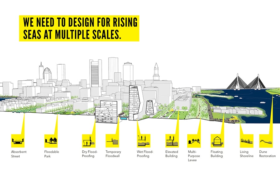
Michael E. Liu, vice president and principal at Boston-based The Architectural Team, writes how the city must move beyond project-by-project responses to rising sea levels.
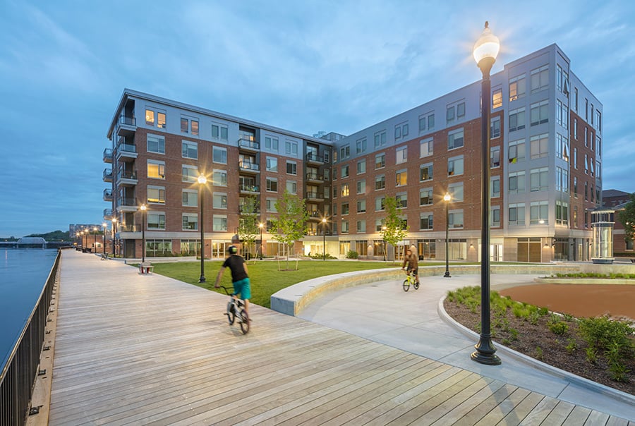
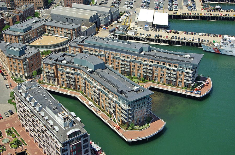
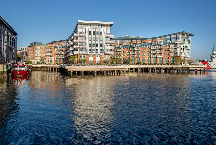
In the absence of broader solutions, designers working on urban waterfront buildings have to respond to the challenge of rising sea levels on a project-by-project basis. Boston, with its regular season of Nor’easters and tide swings of 11 feet or more, has so far relied upon this piecemeal approach; however, it is imperative to change business as usual. We have seen this issue up close: Our practice, The Architectural Team, has been the architect for multiple major waterfront projects on Boston Harbor. They range from Battery Wharf in the North End, with its terraced rigid-structured pier approach to the water’s edge, to Clippership Wharf in East Boston, with its organic living shoreline/building-as-landform approach. In each undertaking, our thinking has reflected an evolving awareness of the challenge of rising sea levels. The first generation of responses was the most obvious: elevating electric rooms, critical building systems, and habitable spaces above anticipated flood levels, and designing water barriers at entry points to buildings. Yet every few years, as the anticipated flood elevations are revised upward, and as FEMA issues new flood maps, the bar is raised—and last year’s resilient project is no longer considered quite so resilient.
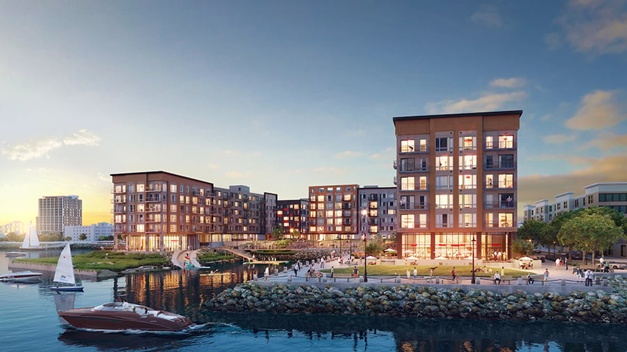
Furthermore, this building-by-building response has created unintended urban design challenges and problematic building forms. Installing first-floor parking is often the default solution, but in removing active floors from the street, this practice impoverishes street life. In some instances, such as at Clippership, the site is large enough and the parking structure sufficiently expansive that the parking level occupies almost the entire site, extending below multiple buildings. With its landscaped roof, the parking level then becomes an artificial landform serving as a new, elevated ground level to buildings sited above it. But urban waterfront projects of a scale that would permit such a solution are rare.
When first-floor retail and commercial programs—all vital to maintain a vibrant streetscape—are permitted below flood elevations, challenges remain. The difficulty of defending large perimeters of glass storefront frequently becomes untenable. Sometimes, if the commercial space only needs to be elevated four or five feet above the existing sidewalk level, a second elevated walkway may be designed against the building to access the elevated commercial spaces, but the strategy removes the storefront from the street in a way that compromises the pedestrian experience.
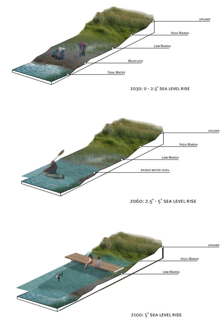
If a waterfront site is large enough, progressive approaches to the water’s edge can replace hard-structure responses, such as seawalls, riprap, and piers. “Living shorelines” are currently the preferred solution. This method returns the water’s edge to a natural vegetated state, allowing the shoreline to change over time and move in and out with motile sea levels. But recognizing that the shoreline will move belies the problem that in a flood condition, resilient buildings may become resilient islands, inaccessible through flooded streets and neighborhoods. Over time, with additional sea level rise, the condition may become permanent, the only clear remedy for which would be to raise surrounding streets—a solution that introduces a whole new set of problems in dealing with existing buildings.
All these strategies, then, are only temporary. In the long term, a broader response is called for, whether on a neighborhood-by-neighborhood basis or a regional one. One example of a neighborhood-based solution is to develop raised landscaped berms along the water’s edge, which could be treated as elevated pedestrian walkways. Such berms are, in effect, dikes that are (ideally) developed as a public amenity in the form of a harbor walk. While a device like this blocks the view of the water from the landward side, the public benefits from access to the water. Obviously, such a barrier must be continuous in order to be effective and must terminate at a higher land form on either end; otherwise, rising water will end-run the barrier and inundate the areas behind it. An example of this approach is our project at Harbor Place in Haverhill. Located along a tidal stretch of the Merrimack River, an existing sea wall was transformed into a raised pedestrian boardwalk concealing a level of parking below.
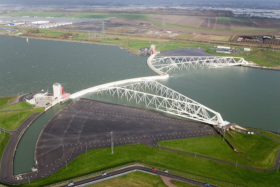
The only tenable long-term solutions are regional and focused on managing the storm surges that create widespread inundation. A 2014 report by the Urban Land Institute included several possible solutions for Boston, including a fanciful proposal to construct a series of canals and sluiceways through the city’s Back Bay neighborhood to redirect water in a storm surge. Several other proposals in Boston have called for connecting harbor islands with dikes. These designs would not bring about permanent stabilization of sea level in the harbor, but rather protect the area from storm surges with gates that would open for boat traffic but close during a storm event. The magnitude of such a project would be daunting, but the Netherlands Delta Works project (which created thousands of miles of storm surge barriers, sluiceways, dikes, dams, and levees) demonstrates that an undertaking like it is possible. In combination with a harbor walk berm system, Boston’s inner-harbor neighborhoods could be protected into the next century, even with mean high-water levels of 7.5 feet over the present condition.
The challenge is huge, especially when considering that such regional solutions require public works of a magnitude that only government can effectuate. Conceived in the 1950s, the Delta Works had an initial budget that amounted to 20 percent of national GDP and required a commitment to construction over generations. As many oceanfront urban centers aren’t good candidates for such an undertaking, the approach must necessarily be one of urban triage based on what’s doable. Boston, however, with its concentrated urban center and chain of harbor islands, clearly qualifies. Project-by-project responses to waterfront resiliency are an immediate and necessary response to the challenge, and developers of individual parcels should be commended for taking whatever measures may be necessary to prolong the viability of each individual project. But such individual responses must be regarded as stopgap measures until universal solutions can be implemented to protect the neighborhoods and communities within which these newer, resilient projects have been constructed.
You may also enjoy “Cities Are Not Technology Problems: What Smart Cities Companies Get Wrong.”
Would you like to comment on this article? Send your thoughts to: [email protected]


Recent Viewpoints
Viewpoints
UIA 2026: No Easy Answers in Barcelona