


April 20, 2009
49 Cities
A new exhibition at Storefront maps our obsession with urban utopias.
I’ll admit that I’ve been thinking about maps a lot these days, particularly our evolving relationship with space and planning now that we have access to so much mapping technology. The way we see the world is changing thanks to innovations like Google Earth and perhaps it’s my recent obsession with bird’s eye views that drew me to Storefront for Art and Architecture this weekend to see Work AC: 49 Cities, Mapping and Measuring the Utopian Metropolis.
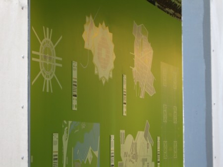
Inside Storefront: the various urban plans on the walls.
When it comes to cities, we’ve always been a bit obsessed with mapping. Many a great mind has applied itself to the formation of the ideal urban plan over the centuries. It was this history of Utopian urban visions that intrigued husband and wife team Dan Wood and Amale Andraos, principals of Work AC. The duo likes to tinker with form and interpretations of urban space and they often experiment with materiality, perhaps best illustrated with their urban farm installation at P.S. 1 last summer.
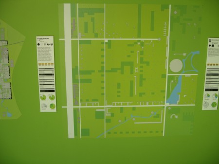
49 Cities is the result of years of comparative study and statistical data crunching that began with a simple question: What would unrealized urban concepts look like today had they been built? 49 different city plans—from Frank Lloyd Wright’s agritopia, Broadacre City, to Corbu’s Ville Radieuse—were analyzed on a subset of categories ranging from space useage and density to population and agriculture. “49 Cities is a call to re-engage cities as the site of radical thinking and experimentation, moving beyond ‘green building’ towards an embrace of ideas, scale, vision and common sense combined with delirious imagination in the pursuit of empowering questioning and re-invention,” Wood and Andraos write about the show.
Close up on Broadacre City.
49 Cities is stunning in the abstract, a beautiful series of clean graphics layered over lime green walls. It’s hard not to be taken in by so many urban plans sitting side-by-side for the first time. Getting into the deeper context behind these graphics, however, is a touch more challenging. The comparative information about each plan is organized onto curatorial plaques that resemble nutrition labels, which is fitting when you consider how much there is to absorb. This is a chewy exhibit. I found myself squinting at line after line of percentages and square footage and wondering how to put it all together. I also wasn’t clear on the icons used to help define aspects of each of the plans. There is little by way of set-up or explanation in the show itself, so this is an exhibition that requires its catalog as accompaniment. At $25, the book includes introductory essays by the curators as well as a very important key to the diagrams. If an outlay of funds isn’t in the budget these days, you can download the first 20 pages of the book for free off the Storefront Web site. I highly recommend doing that before seeing the show. 49 Cities runs through May 30.
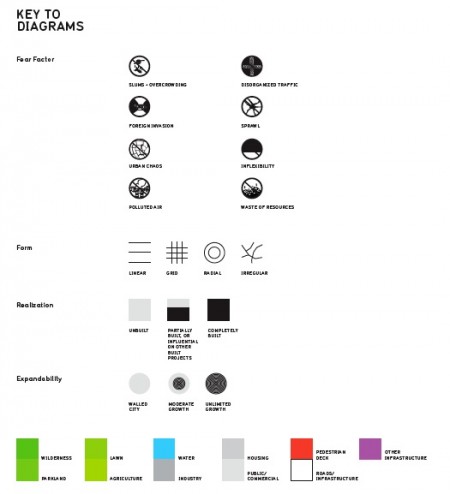
A key to the graphics.


